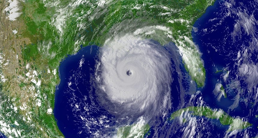
Hurricane Debby: Florida Faces Flooding and Storm
Table of Contents
Hurricane Debby is the 4th hurricane of the 2024 Atlantic season, following Tropical Storms Alberto, Beryl, and Chris, which formed in June.
As it neared Florida on Sunday night, Tropical Storm Debby became a Category 1 hurricane, according to the National Weather Service.
Forecasters warned of heavy rainfall, tropical cyclones, and significant river flooding expected in Georgia, South Carolina, and Florida.
The hurricane center predicted the storm would hit land on Monday around noon in the Florida Big Bend region. Up until 6 a.m. early Monday, there was also a tornado watch for a portion of Northern Florida and Southern Georgia.
Beginning on Tuesday, Debby is expected to move eastward over northern Florida and then stop over the coastal areas of Georgia and South Carolina. This would cause the region to experience potentially record-breaking amounts of rain, up to 30 inches.
Along Florida’s Gulf Coast, officials have also issued a warning about potentially fatal storm surges. On Monday, forecasters predict that inundation between the Suwannee Rivers and Ochlockonee will reach six to ten feet.
At 11 p.m., the hurricane center reported Hurricane Debby with maximum sustained winds of 75 mph, located about 100 miles west of Tampa, Florida. The storm was traveling 19 kph northward.
Forecasters issued tropical storm warnings for Florida’s West Coast, the southern Florida Keys, and Dry Tortugas. They also issued hurricane warnings for portions of the Florida Panhandle and Big Bend. A tropical storm monitor was in effect for the Panhandle and further west.
Hurricanes and tropical storm-force winds have the potential to overwhelm canals and drainage systems and cause river flooding. Forecasters predicted rainfall amounts of 6 to 12 inches, with isolated areas of Florida potentially receiving close to 18 inches.
Florida Hurricane: Storm Surge Warnings Announced
A hurricane warning is in place for Yankeetown to Indian Pass, indicating that hurricane conditions in the area.
Forecasters usually issue this warning 36 hours before the first predicted occurrence of tropical storm-force winds, making outside preparations hazardous or difficult. Hurrying to get ready to safeguard people and property is a good idea.
A hurricane watch and tropical storm warning are in effect for the Florida coast south of Yankeetown to Boca Grande. This includes Ponte Vedre Beach to the South Santee River in South Carolina and from west of Indian Pass to Mexico Beach.
A life-threatening storm surge warning is in place for the Florida coast, encompassing Tampa Bay and extending northward from the center of Longboat Key to Indian Pass. Additionally, the coasts of South Carolina, Georgia, and the Mouth of St. Mary’s River extend to the South Santee River.
Emergency managers in New England and New York were already keeping an eye on the storm’s trajectory in case any remnants made landfall in their states.
Following weeks of intense rain and thunderstorms, several states, including Vermont and New York, were still dealing with flooded areas and soggy ground.
Catastrophic flooding will probably result in areas of South Carolina and southeast Georgia due to potentially historic heavy rainfall that continued through Friday morning.
Through Friday, there will probably be significant flooding impacts from parts of northern and central Florida through the Carolinas’ Coastal Plain due to heavy rainfall.
Hurricane Debby: Florida Counties Ordered to Undergo Mandatory Evacuations
Alachua County
Levy County
Taylor County
Wakulla County
Citrus County
Authorities advise everyone in tents, campers, manufactured homes, or mobile homes to evacuate from all low-lying areas. These structures may not withstand sustained winds of up to 60 mph. Required Zone A
Dixie County
On Sunday, August 4, 2024, at 2:00 p.m., evacuations will start for all coastal communities, including Horseshoe Beach and Suwannee. This includes Jena, the immediate vicinity, substandard housing, and all low-lying areas within the county.
Franklin County
Starting at 6 a.m. on Sunday, August 4, 2024, evacuations will be required for all barrier islands and flood-prone areas. This includes St. George Island, Dog Island, Alligator Point, and low-lying areas near RV parks, coasts, and rivers.
Should the storm intensity or track alter, more evacuations might be ordered.
The Hurricane Approaches Florida with Category 1 Strength
In summary, Hurricane Debby has strengthened into a Category 1 storm with high winds of 75 mph as it gets closer to Florida. Forecasters predict that the storm will come ashore in the Florida Big Bend region by Monday at noon.
It is expected to bring with it dangerous storm surges of six to ten feet along the Gulf Coast, heavy rainfall, and possibly even river flooding. Our thoughts are with everyone in the path of the storm—stay safe and take all necessary precautions to protect yourselves and your loved ones.


